
Trafalgar St
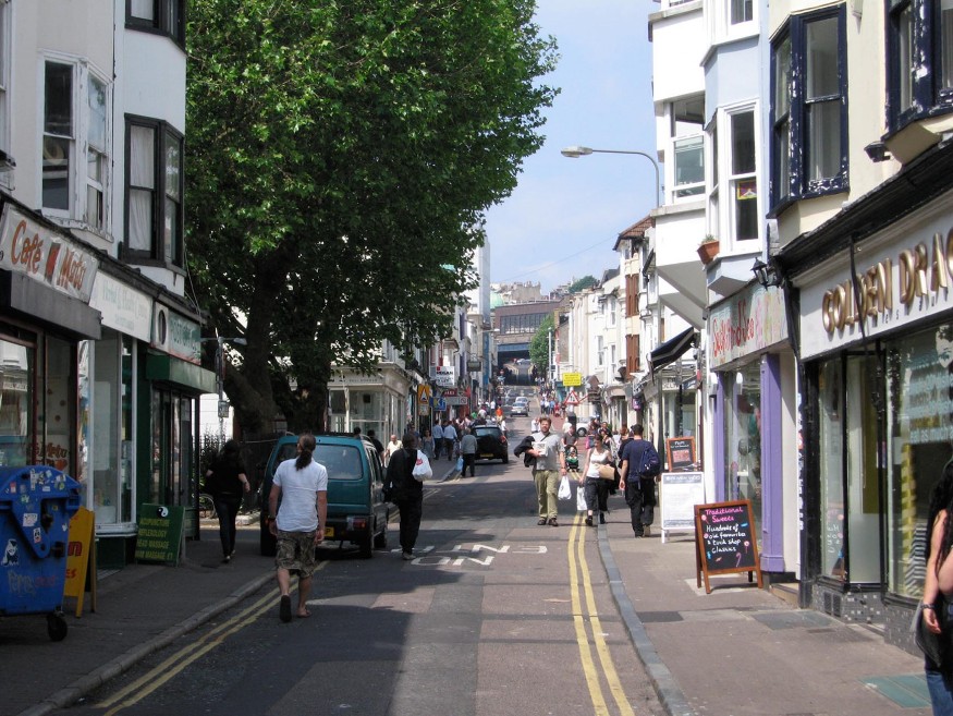
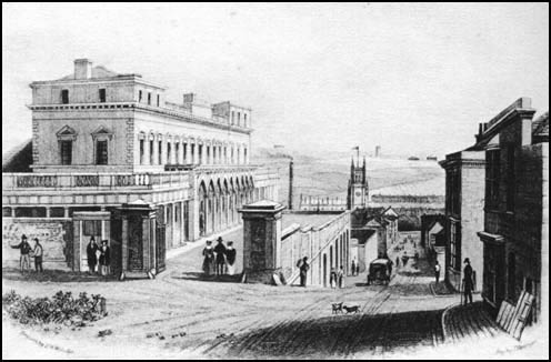
Trafalgar
Street was originally named Trafalgar Place and was
one of the east-west leakways (tracks)
that acted as a boundary between the 3rd and the 4th 'furlongs'. ('Furlongs'
were sections of agricultural land into which the North Laine was divided until
landowners began selling off land for building development in the early part of
the 19th century.) Development of Trafalgar Place began in the early part of
the 19th century with a few houses built at the eastern end. It was not until
the coming of the railway in the 1840s that there was large-scale development of the street (an 1821 map
refers to Trafalgar Street). Like all the other 'leakways' (Church Street,
North Road, Gloucester Road), Trafalgar Street was to develop into a main
thoroughfare.
Sheep on
their way to the slaughterhouse
A hundred years ago farmers would bring sheep or cattle to
Brighton and then drive them to the many slaughterhouses in the area. It was
quite usual for butchers to select their own animals for slaughter and indeed
to help in the slaughtering of the animals. The butcher who lived at No 16 even
had his own slaughterhouse on the premises. No 16 was later bought by the
Goldberg family who set up a small garage in 1921 and later established a
successful business making coffins and providing transport for burials at
Florence Place, Ditchling Road. Their full story is told in We're
not all Rothchilds! by Leila Abrahams. You
can still see the green tiles and the garage door with the inscription 'Grand
Parade Garage - established 1918'.
The 1849 health report
Besides the slaughterhouse at No 16 there were also slaughterhouses nearby in Vine Street, Cheltenham Place and Oxford Place (the other side of London Road). In 1849 the government appointed a commissioner to investigate Brighton's health and particular reference was made by Edward Cresy, the Commissioner, to these slaughterhouses and their difficulty in getting rid of the dung and refuse.

It was common practice to sink the dung in the nearest cesspool, with the blood being given to pigs (often kept in the cellars with the poorest of families). These cesspools often contaminated the wells which provided water for the local families, resulting in epidemics of typhoid. Diseases like typhoid, cholera, scarlet fever and consumption were common among the poor and Trafalgar Street was mentioned by Cresy as being one of the worst, although not quite as bad as Orange Row and surrounding areas.
Prosperous years
By 1900 Trafalgar Street was entering a prosperous phase. A glance at the trade directories for the period reveals a street that had become a major shopping destination. People came to the area from all over Brighton and indeed from London. Major stores like the Co-op and Freeman, Hardy & Willis were trading along with fishmongers, dressmakers, butchers, watchmakers and gents' outfitters. There was still small scale industry (a manufacturing chemist, confectionery, dairy) but Trafalgar Street was very much now a major retail street. The residents of the nearby streets could purchase all their needs in this street.
Always a
main route to the station
As well as a through route for cattle and sheep, Trafalgar Street
has always been a main route to the station. Even today in the early morning
and evening the pavements are full of people rushing to catch their trains to
often far off destinations. In the early part of the century you would have
seen many a church or Sunday School outing to some of the villages in the
country like Burgess Hill or Hassocks which had pleasure gardens and plenty of
fresh air.
In recent years
Nowadays Trafalgar Street is a very busy street linking the London
Road area with the station. It has become dominated by traffic and restaurants.
The Council has enhanced the top end of the road where it accesses the station
but the rest of the street with its narrow pavements and busy traffic remains
an unpleasant street for pedestrians. Much of the original building on the
northern side was knocked down to be replaced by Trafalgar Place, an office
complex, although there are plenty of examples of Victorian North Laine on the
southern side.
The
Prince Albert pub
Near the top end by Frederick Place is the Prince Albert pub, a
listed building from the 1840s and a live music venue which hosted one of the
gigs for the launch of the North Laine Community Association's CD.
For more information on Trafalgar St go to: http://www.mhms.org.uk/content/trafalgar-street

Related Pages
